The best larch hikes in Washington state
In this blog post I’m sharing the BEST fall larch hikes in Washington state! The hikes below include trails in the North Cascades, Central Washington, and Eastern Washington. Several of the trails are easy, but the majority of the hikes we share below are moderate or challenging. In addition to hiking trail details, I also share information about peak color timing for each of the Washington larch hikes listed below.
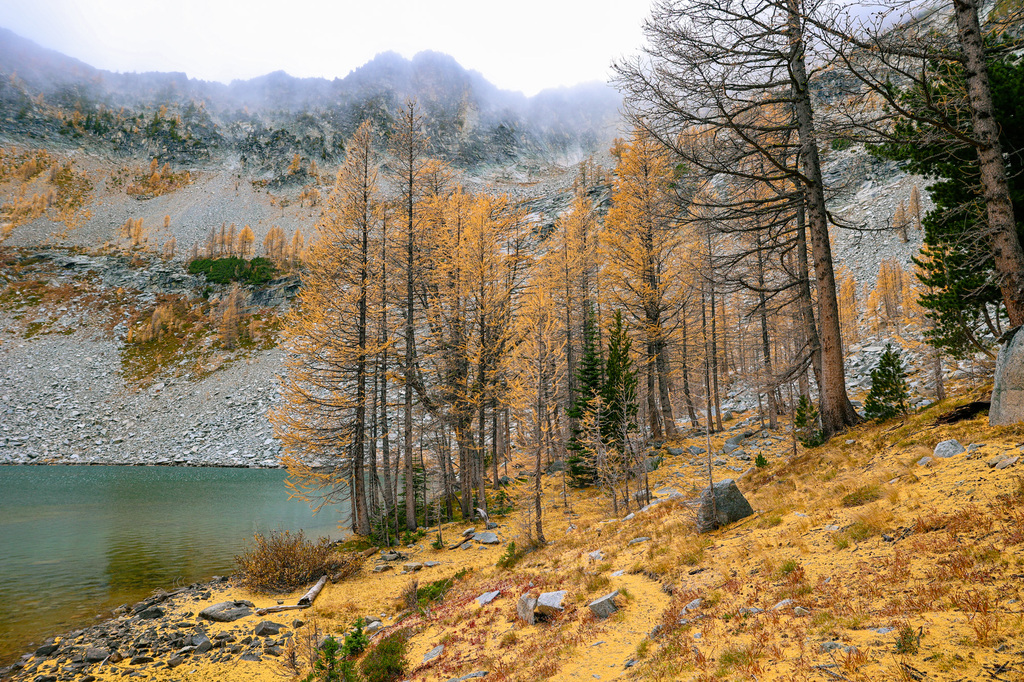
In Washington state, peak larch season is usually in early-mid October every year. This guide will help you plan the best fall hikes for seeing Washington’s larches.
What are larches? Larches are a famous deciduous conifer that is known for its stunning yellow color in fall. They look like regular pine trees, but they turn bright green and then bright yellow in fall before dropping all of their needles.

Welcome!
We’re Gwyn and Ami. Based in Spokane, Washington, we’re your guides to the Pacific Northwest and beyond!
We’re adventure travel experts, and our blog is all about helping you find the best hikes, weekend getaways, and national park adventures in the United States and abroad. You can find more on Instagram @gwynandami.
The best larch hikes in Washington
Below I share the best fall larch hikes in Washington state! These hikes are best done between early and mid-October for peak color, but this can change from season to season.
Leave no trace tips for larch season
Before we share the best fall larch hikes in Washington, below I’m sharing some leave no trace (LNT) tips for larch season. Many of these hikes are in fragile alpine environments, so visitors must take extra care when hiking to see the larches.
Please read this section carefully. We can all work together to help keep Washington beautiful and preserve these places for generations to come. See below for our top leave no trace tips for larch season.
Leave no trace tips for hiking and backpacking in Washington during larch season
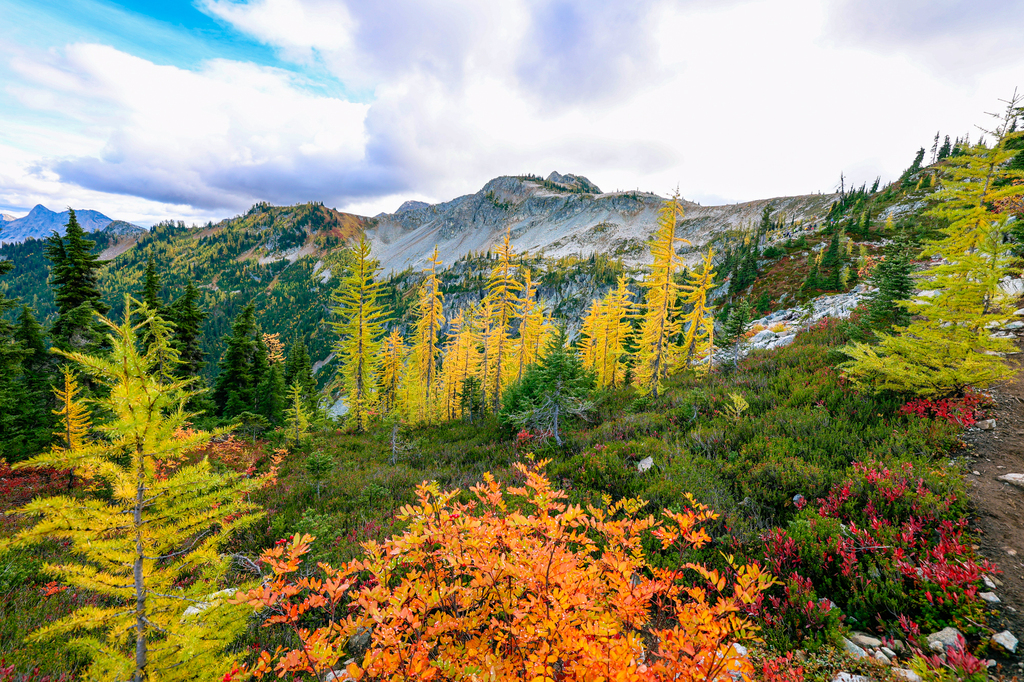
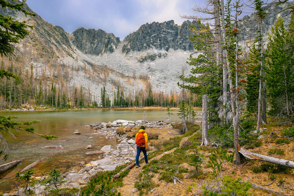
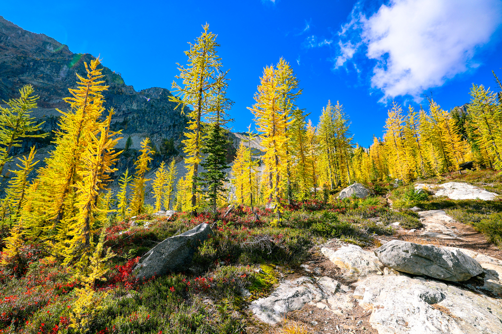
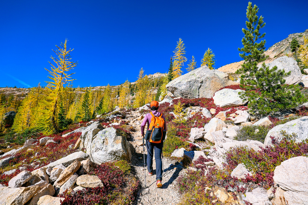
Protect alpine vegetation by staying on trail. Alpine vegetation is fragile, and it’s essential that you watch your step and stay on trail whenever possible. Heather, which is pictured above, is especially important for stabilizing alpine soils and allowing other plants to thrive. Heather communities take thousands of years to grow, yet a few tramples with a careless step can kill it. Avoid cutting the trail or widening trails in order to avoid muddy spots.
Camp in established sites. If you’re backpacking, use established sites in order to avoid crushing sensitive vegetation. Avoid camping too close to the lake, as this can contaminate the water. Dishes should be washed 200 feet or more from the lake. Click here to learn more about doing your dishes in the backcountry.
Leave it better than you found it. Washington trails get a lot of love during larch season. Please leave it better than you found it by packing out ANYTHING you see along the trail. Every little candy wrapped scrap you pick up makes a real difference!
Be prepared. Part of leave no trace is being prepared. In fall, you should always be ready for the possibility of cold weather, snow, or rain in the mountains. Conditions can change fast! I recommend packing plenty of warm layers, food, and emergency supplies for all fall hikes. We wore cozy layers from Title Nine on several of these adventures, and they kept us warm and comfortable during our adventures!
Fall hiking bucket list: the best larch hikes in Washington
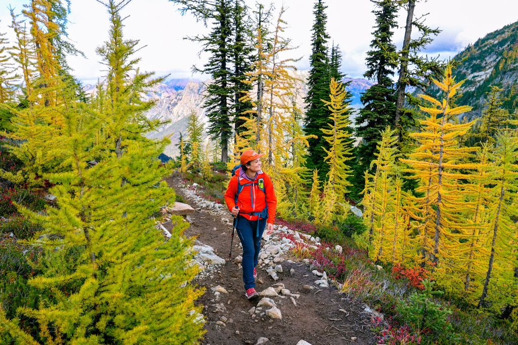
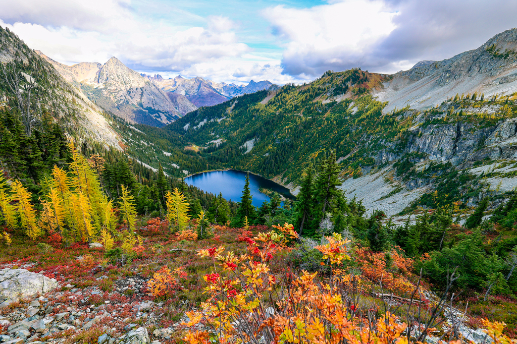
Maple Pass loop
Trail stats: 6.5 miles (round trip), 2,162 feet of elevation gain
Road and trailhead conditions: The parking lot is paved, and you are also allowed to park on the shoulder of Highway 20. There is a bathroom at the trailhead.
Maple Pass and Lake Ann is arguably the most popular fall hike in the North Cascades. Offering one of the most scenic loop hikes in Washington, the trail is located in the Okanogan-Wenatchee National Forest, near North Cascades National Park.
This hike delivers nonstop views of jagged peaks, Lake Anne, and TONS of yellow larches and fiery red huckleberries. Despite the elevation gain, it’s extremely popular. Expect a busy trailhead, especially during peak larch season. Hikers sometimes have to park MILES away from the trailhead on peak weekends in fall.
Hiking counterclockwise, the trail begins with a gentle ascent through the forest. At about 1.5 miles into the hike, you will reach a branch in the trail. Going left will take you to the shores of Lake Ann; staying right will continue the loop around the lake. As you gain elevation, the views open up dramatically, and you will see the stunning Lake Ann below. As you continue climbing, you’ll see panoramic vistas of the rugged North Cascades. This is also where you’ll start to see the hike’s iconic larches.
Most hikers complete the loop counterclockwise for a more gradual ascent and steeper descent. There’s no scrambling required, but trekking poles are helpful for the downhill.
Water is only available at the lake (you need to filter it). In fall it’s unlikely you’ll find any water along the trail. You do not need a permit to hike here. Backpacking and camping are not allowed along this trail. Trekking poles are helpful for this hike. See below for our top recommendation!
Trekking Poles
We recommend the REI traverse trekking poles, which are a good mid-range option in terms of weight and cost. Want more gear recommendations? See our full hiking gear guide below.

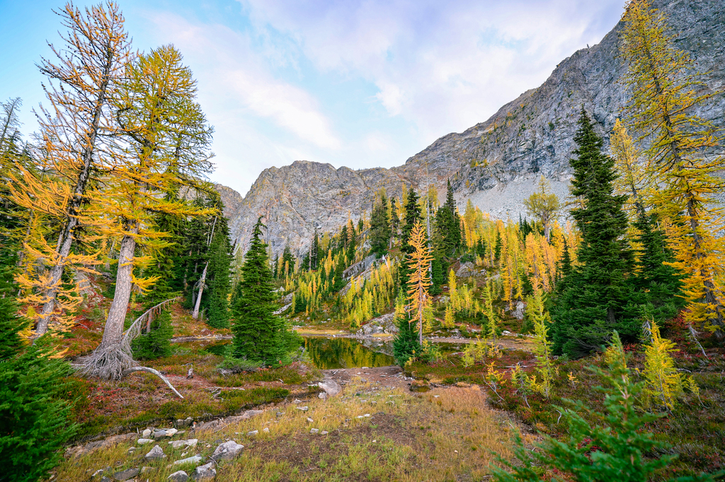
Blue Lake
Trail stats: 4.6 miles (round trip); 915 feet of elevation gain
Road and trailhead conditions: Blue lake has a small parking lot with a pit toilet. During fall, the lot tends to fill up and hikers must park along the road. Exercise caution when walking along busy Highway 20, as the cars move quickly!
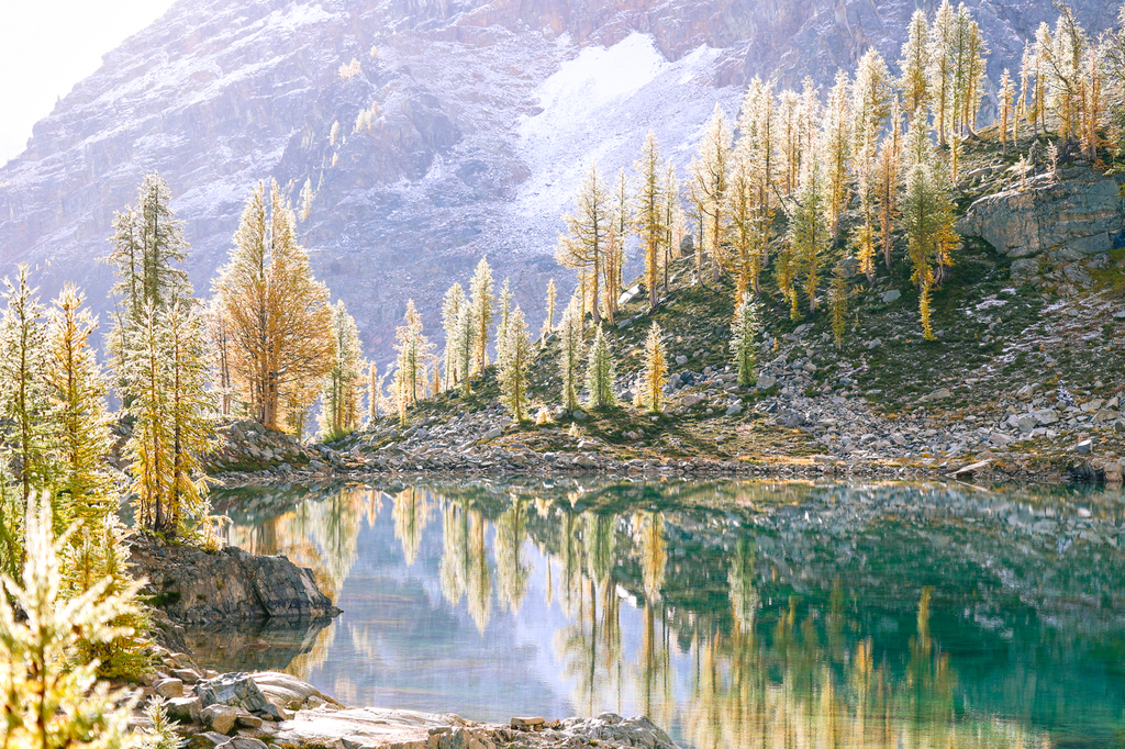
Blue Lake is one of the easiest larch hikes in the North Cascades! The trail passes through forest before ascending up the mountain to a stunning alpine lake. You’ll begin seeing larches about 1.7 miles into the hike, at the cutoff for Liberty Bell (a climbing route). The lake itself is surrounded by the golden trees, and they’re especially pretty in the early evening.
Please be sure to respect roped-off areas and closed segments of trail. The Forest Service is working hard to restore this fragile alpine environment after years of overuse. We saw one young woman blatantly stepping over the ropes to take selfies, and it made me sad (she also didn’t care when I asked her to step back onto the main trail). Colors were close to peak when we visited in early October 2025.
Shop our hiking gear!
Not sure what gear you need to pack for your next epic hike? Check out our full 2025 hiking gear guide, which includes the best hiking gear for summer, winter, and year-round hiking.

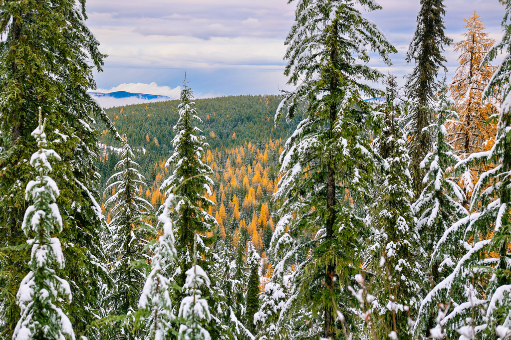
Quartz Mountain Lookout Trail, Mount Spokane State Park
Trail stats: 4.5 miles (round trip); 685 feet of elevation gain
Road and trailhead conditions: There is a large paved lot where visitors can park.
More larches in Spokane, Washington? You bet! I have NEVER heard anyone talk about the larches of Mount Spokane, but this area is FULL of them! In fall this entire mountain turns a brilliant yellow hue, and it’s a sight to behold. Quartz Mountain Lookout Trail is a relatively easy trail. From the top you’ll get panoramic views of Mount Spokane State Park, with TONS of larches. You can also snowshoe here. In 2024 the eastern Washington colors here were at their peak in early November (and there was enough snow for snowshoeing OR snow hiking!), making this a good late-season larch hike in Washington.
A Washington state parks pass is required to recreate here. Later in the winter season a special winter recreation pass is required.
More recommendations for the best places to see fall colors in Spokane can be found here.
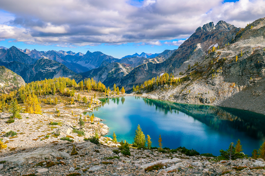
Colchuck Lake (and the Enchantments Traverse)
Trail stats: 8.7 miles (round trip), 2,300 feet of elevation gain
Road and trailhead conditions: Hikers wishing to do Colchuck Lake will have to drive a fairly long and steep road up to the trailhead. Moderate clearance is recommended (I’m not sure our Toyota Corolla would make it…). There is a bathroom at the trailhead. Parking at the trailhead is limited.
Colchuck Lake is one of Washington’s most famous lakes, and for good reason. It’s gorgeous in every season, but in fall the lake is surrounded by stunning yellow larches. In 2023 we did this trail in mid-October and saw tons of gorgeous yellow larch trees at peak color! It’s a challenging day hike, which can easily be extended into the Enchantments Core to make it even more epic. You won’t see many fall colors along the trail itself, and the majority of the larches are located at the southern tip of the lake, below Aasgard Pass.
You need to fill out a free day hiking permit at the trailhead. Please make sure to leave no trace by packing out EVERYTHING you pack in, including apple cores and orange peels.


Crater Lakes
Trail stats: 7.3 miles (round trip); 2,200 feet of elevation gain
Road and trailhead conditions: Moderate clearance is recommended to reach this trailhead. Parts of the road are quite steep! The parking lot is large, and there is a bathroom available.
Several other trails in the region share this name. The Alltrails link to this specific trail can be found here.
Located in Okanogan-Wenatchee National Forest in Central Washington, this beautiful larch hike is a great way to avoid the crowds! This hike features a gradual but steady ascent until you get to lower and upper Crater Lakes. The larches are predominantly located close to the lakes, and not along the trail. You can horse-camp and backpack here, and the lake beautifully reflects the surrounding mountains.
We did this hike in mid-October in 2024, and the larches were past their peak.
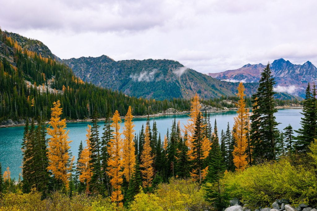
Wing Lake and Lewis Lake
Trail stats: 9.5 miles (round trip), 4,000 feet of elevation gain
Road and trailhead conditions: The parking lot is mostly paved, and you are allowed to park on the shoulder of Highway 20. This hike starts from the same trailhead and route as Maple Pass.
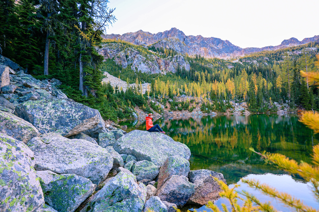
Lewis Lake and Wing Lake is a rugged, rewarding adventure deep in the North Cascades. It’s also one of the most beautiful larch hikes in Washington! The route starts on the Maple Pass trail before branching off toward Lewis Lake. Many beautiful larches can be found right where the trail branches off. The trek to Lewis consists mostly of a 1-mile-long bounder field that can feel tricky and tedious to traverse. Follow the primitive cairns (rock stacks). Good footwear and route-finding skills are essential. Eventually you will reach Lewis Lake, which is a stunning turquoise color!
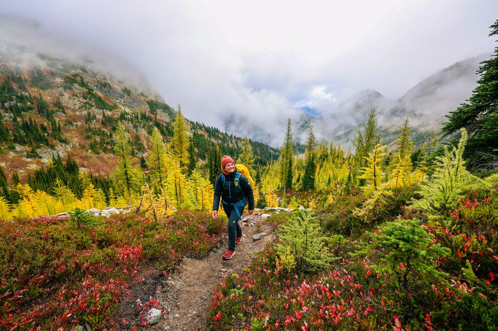
From Lewis Lake, the climb to Wing Lake is steep, but slightly less rocky. This part of the hike is a hotspot for larches! In early October 2025 the larches were a mix of green and yellow.
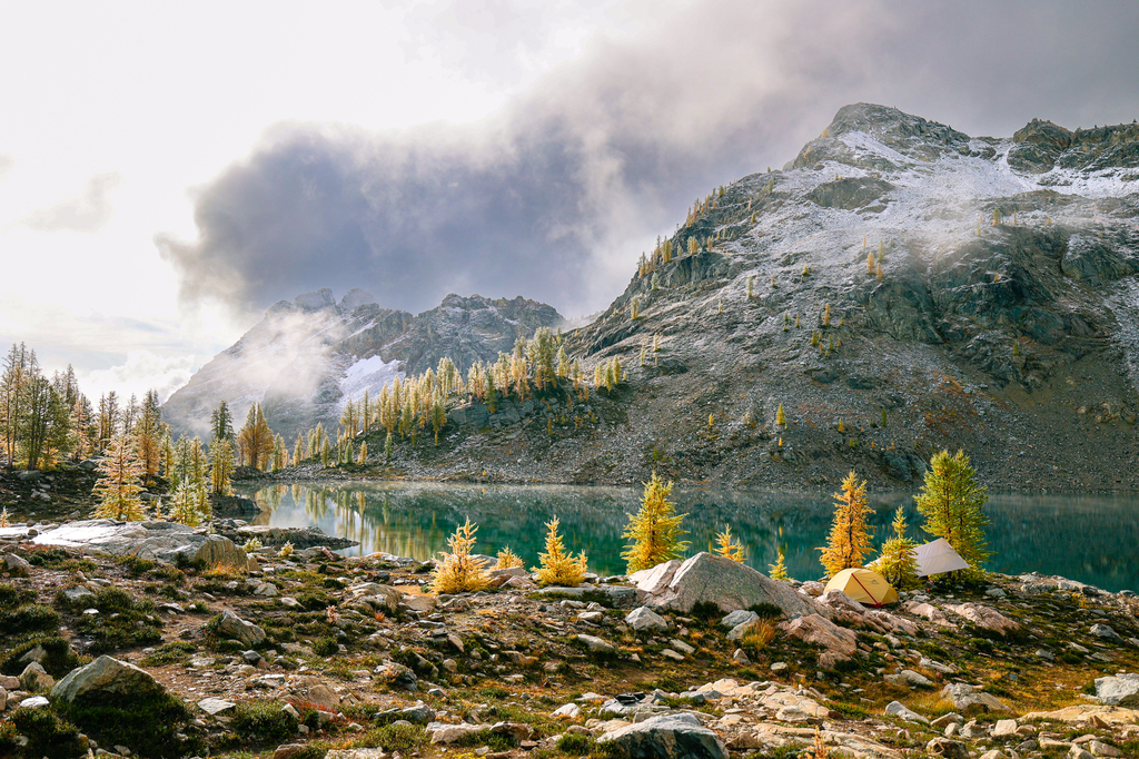
Wing Lake sits in a stunning cirque beneath Black Peak, with panoramic views and a peaceful alpine setting. It’s a popular place to backpack, and you may see some climbers attempting to climb Black Peak. There are a number of larches surrounding the lake, making this a popular spot for fall backpacking. Sites are very limited, so go on a weekday, or arrive at Wing Lake prior to 10 am on a Saturday if you want a campsite.
Click here to read our full guide to backpacking at Wing Lake.
Cutthroat Lake
Trail stats: 3.8 miles (round trip); 498 feet of elevation gain
Road and trailhead conditions: The parking lot is about 1 mile from Highway 20. It is mostly paved and easy to drive with any vehicle, though there are some potholes. There is a bathroom at the trailhead.
Cutthroat Lake is another easy larch hike in the North Cascades! This hike follows a gradual incline through the forest. About 1.5 miles in you’ll come to a fork in the trail. Head left over a newly built log bridge and, shortly thereafter, you’ll arrive at the lake. Along the far shore you’ll see tons of beautiful golden larches on the mountainside. We also saw a black bear walking across the boulder field! The lighting here is best in the late afternoon and early evening, when the lake is in shade (we’ve done this hike several times at mid-day and it’s just not the same!). Pack a jacket – it gets cold fast!
In early October 2025 there were lots of stunning red and yellow bushes along the trail. I would estimate the larches around the lake were at about 70% peak.
Iller Creek Conservation Area
Trail stats: 5 miles (round trip); 1,243 feet of elevation gain
Road and trailhead conditions: There is a small parking lot. This area is free to visit. Note that there are several popular hiking routes here, with shorter and longer route options!
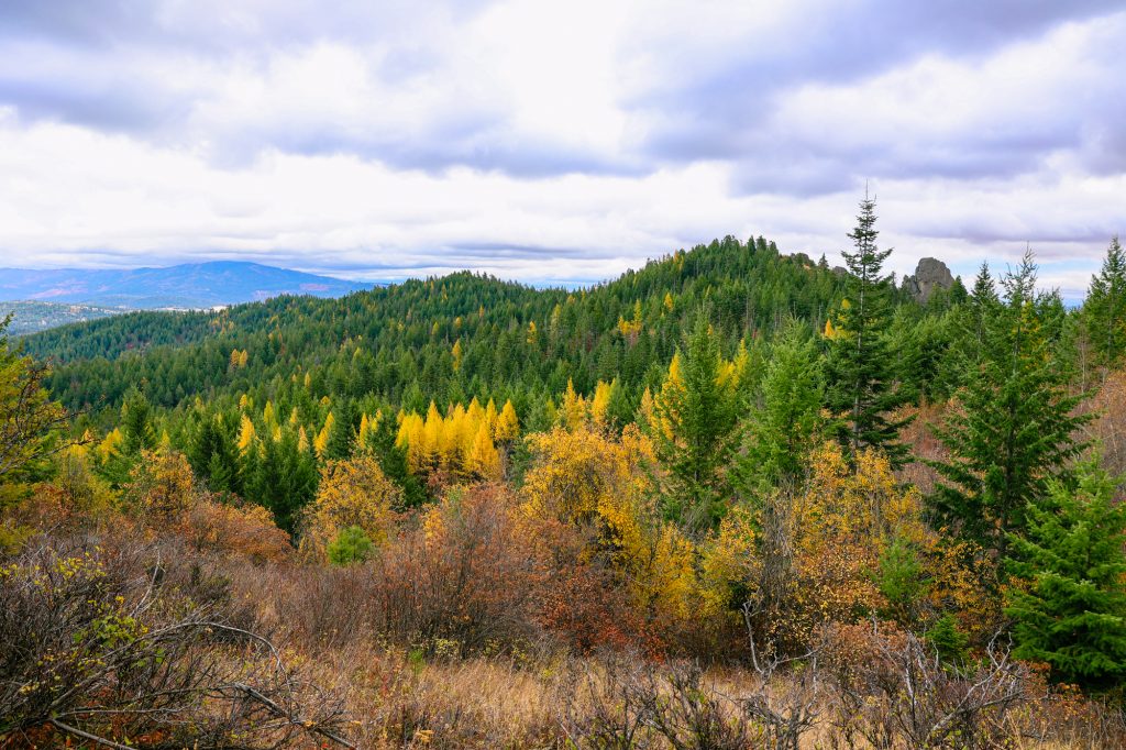
I honestly didn’t think we had larches in Eastern Washington, but you’ll find TONS larches along the Iller Creek Conservation Area Trail in Spokane Valley! At 5 miles long and 1,200 feet of elevation gain this hike will give you a workout without being TOO challenging. Along the way you’ll pass by several stands of golden larches. Because they’re at a lower elevation, these larches tend to remain yellow long after the iconic larches of Leavenworth and the North Cascades have lost their color. In 2024 the larches at Iller Creek Conservation Area were still looking great during the last week of October, making this a great hike for people that missed peak larch season in the North Cascades.
More recommendations for the best places to see fall colors in Spokane can be found here.
Eagle Lakes
Trail stats: 11.8 miles (round trip); 2,604 feet of elevation gain
Road and trailhead conditions: Moderate clearance is recommended to reach this trailhead. Parts of the road are quite steep! The parking lot is large, and there is a bathroom available.
Several other trails in the region share this name. The Alltrails link to this specific trail can be found here.
I think this is one of the best (and least talked about!) larch hikes in Washington! At almost 12 miles this is a difficult hike, but the reward is worth it. This trail leads to a beautiful alpine lake, and it’s absolutely surrounded by stunning yellow larches!
The trail leaves from the same trailhead as Crater Lakes (above), and climbs steadily to upper Eagle Lake. You also hike to “Eagle Lake,” but it will add several miles (we didn’t do this).
We did this hike in mid-October in 2024, and the larches were past their peak.
Cutthroat pass via Cutthroat Lake
Trail stats: 11.9 miles (round trip), 2,477 feet of elevation gain
Road and trailhead conditions: The parking lot is about 1 mile from Highway 20. It is mostly paved and easy to drive with any vehicle, though there are some potholes. There is a bathroom at the trailhead.
Cutthroat Lake and Cutthroat Pass is a scenic hike in the North Cascades. Located just off Highway 20 in the Okanogan-Wenatchee National Forest, this trail offers alpine lakes, larch trees, and expansive views. It’s a great option for hikers and backpackers alike who are looking for a moderately long trail with beautiful larches.
This trail starts off along the same route as Cuthroat Lake (found earlier in this guide), but is significantly more difficult. Once you pass the lake, the trail gradually climbs to Cutthroat Pass, winding through forest and rocky terrain along a series of gentle switchbacks. You’ll begin to see larches about halfway up this hike.
As you approach the pass, the views of the landscape open dramatically. You’ll see the jagged peaks of the North Cascades, including Liberty Bell. Once you reach the pass you’ll intersect with the Pacific Crest trail, and you’ll see Cutthroat Lake far below. In fall you’ll see lots of larches up along the pass. Backpacking is allowed, with camping options along the pass. Water is available at the lake (to filter), but is otherwise very limited, so plan accordingly.
The best larch hikes in Washington state: final thoughts
I hope you enjoyed our post about the best larch hikes in Washington State! If you plan an adventure based on our recommendations we would love to hear about it!
Larch season in the Pacific Northwest is brief, but beautiful. If you visit these special places please stay on trail and respect the natural environment. We can all work together to preserve Washington’s beauty! Finally, if you venture into the mountains, please be sure to pack lots of layers. You can find our favorite hiking gear and clothes here.


